


A unique feature of the Union High School and indeed Graaff-Reinet is the intricate system of furrows which was once upon a time used to disperse water to the properties in the town.
Each erf had a specific hour of the day where the owner would remove his or her sluice and flood the property with water from Mackie’s Pit. No matter what time of day or night, property owners would use this valuable water to keep lawns and gardens alive.
This system has largely fallen by the wayside, most likely as a result of improved municipal water systems, and the furrow water is now only used by the Botanics Sports Grounds, the Graaff-Reinet Bowling Club, the Union Schools, and to a lesser degree Hoër Volkskool.
The water originates from the spring known as Mackie’s Pit, which is roughly 5km north-east of the Nqweba Dam wall. It is piped from under the dam itself, under the dam wall, along the Sundays River to the Mackie’s Pit Collector Dam (near the old municipal swimming pool, along Cradock Street, through residential properties to Stockenstroom Street, where it crosses underneath the street, and via the Botanics irrigation dam to the other users.
Here follows a brief history of the origin of Mackie’s Pit:
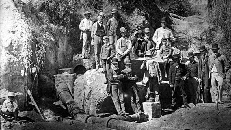
In the early 1860s, W.L. Mackie, the Town Clerk, dug a hole in the sandy flats which lay between the old river bank and the course of the river as it was in the 1860s. Although floodwaters did not reach most of this flat, the quantity of vegetation growing there suggested that there must be water under the surface.
Mackie confirmed this and, from the levels he took, it appeared that the level of water in the pit was some eighteen inches higher than that in the river. This led to the belief that the water in Mackie’s Pit was not connected with the river.
This was extremely important since it meant that the board would be able to dispose of this water without reference to the erf-holders, who were entitled to all the water in the river.
But when the supply of water at Mackie’s Pit was tested in 1873, it was discovered that the levels taken by Mackie had been incorrect and that the level of water in the pit was in fact about a foot lower than the level of water in the river.
These levels indicated “that the underground water was connected with the river, and not with lateral springs – that it is, in fact, a portion of a large body of water which percolates through a vast shingle bed, several miles in width, and which is known to exist on both sides of the river”.
– 𝘌𝘹𝘵𝘳𝘢𝘤𝘵𝘦𝘥 𝘧𝘳𝘰𝘮 ‘𝘍𝘳𝘰𝘯𝘵𝘪𝘦𝘳 𝘵𝘰 𝘔𝘪𝘥𝘭𝘢𝘯𝘥𝘴 𝘈 𝘏𝘪𝘴𝘵𝘰𝘳𝘺 𝘰𝘧 𝘵𝘩𝘦 𝘎𝘳𝘢𝘢𝘧𝘧-𝘙𝘦𝘪𝘯𝘦𝘵 𝘋𝘪𝘴𝘵𝘳𝘪𝘤𝘵, 1786 – 1910’ 𝘣𝘺 𝘒𝘦𝘯𝘯𝘦𝘵𝘩 𝘞𝘺𝘯𝘥𝘩𝘢𝘮 𝘚𝘮𝘪𝘵𝘩 (𝘚𝘦𝘱𝘵𝘦𝘮𝘣𝘦𝘳 1974)


